
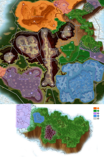
Size of this preview: 397 × 599 pixels. Other resolutions: 159 × 240 pixels | 1,024 × 1,544 pixels.
Original file (1,024 × 1,544 pixels, file size: 2.47 MB, MIME type: image/png)
| This file and the description below the red line are loaded from our central media archive atys.wiki.ryzom.com. |
File history
Click on a date/time to view the file as it appeared at that time.
| Date/Time | Thumbnail | Dimensions | User | Comment | |
|---|---|---|---|---|---|
| current | 11:54, 28 August 2020 | | 1,024 × 1,544 (2.47 MB) | Dorothée | Add Mixed ecosystems zones |
| 08:41, 7 July 2020 |  | 1,024 × 1,544 (2.52 MB) | Dorothée | Correction : Jungle areas in Verdant Heights | |
| 08:50, 26 May 2020 |  | 1,024 × 1,544 (2.53 MB) | Dorothée | Atys ecosystems map Category:Map images Category:Ecological images |
File usage
The following page links to this file: